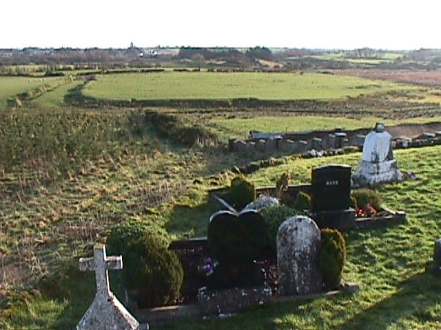
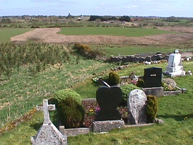
The first photograph of the Hill of Grange (and surrounds) shown
below was taken on January 8th 2001. The second photograph was taken on April 16th 2001.
As can be seen by comparing the two, major changes have been made to the large
"field" shown in the top third of the photographs.This unusual looking field structure was very strategically positioned
between the Hill of Grange itself, and the area where the ancient Esker Riada roadway used
to be (just on side of the field furthest from the camera).
No clear sign of the east-to-west Esker Riada ridge appears in
either of the two photographs below, and this is because the section concerned was
quarried out (for its sand and stones) by Galway County Council during the 1950/60's. A
large part of the quarried out section was then later used as a rubbish dump (between 1971
to 1989) for County Galway.
| The Esker Riada has played
a major role in Irish history, and indeed in European and world history as well. This is
partly because of the very close physical relationship it has with places such as Turoe and Clonmacnoise
(founded in the 540's). In effect, this natural 120 mile long ridge and
roadway was one of the main backbones on which Ireland's ancient history was built. Clonmacnoise (with its many students from several
European countries) was, it is thought, the world's first major Christian university: as
well as being the most influential (very probably).
According to Ptolemy's ancient map of
Ireland, the Turoe/Knocknadala area was
(around the time of Christ) one of the two main Celtic royal sites in Ireland at that
particular time. ("Knocknadala" in the Celtic language means "Hill of
Parliament".)
The Turoe/Knocknadala area is
approximately 4 miles to the west of the "field" shown below at Grange; and Cross,
one of the three areas in east Galway earmarked as a possible site for a new superdump (for the whole of Connacht) is roughly
half way between Grange and Turoe/Knocknadala. |
|
|
"Before and after" photographs (of site
destroyed near Grange
in early April 2001) can be seen further down this page.
|